

At home I had more chance to explore the capabilities of the software. I tried some of the pre-made styles for the map and came up with some ideas on how to slightly amend them. I used different shades for the water colour and main road colour.

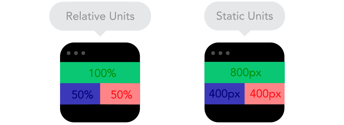
Where static units were used in the code for any element’s width I changed them to relative which ensures that the content is responsive and displayed appropriately on a broad range on devices)
It took me some time to get how to save a style and export it in a Squarespace-accessible format. I found a solution which basically required putting a code block in Squarespace and embed the map with an iframe tag.

Comments
Post a Comment